


aiguillette des houches

Bernadette Noirant
User
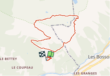

Length
10.6 km

Max alt
2276 m

Uphill gradient
981 m
Km-Effort
24 km

Min alt
1355 m

Downhill gradient
977 m
Boucle
Yes
Creation date :
2020-10-18 08:46:39.679
Updated on :
2020-10-18 14:03:02.87
5h14
Difficulty : Difficult

FREE GPS app for hiking
 SityTrail
IGN / Geographical institutes
SityTrail Plus
The world is yours!
About
Trail Walking of 10.6 km to be discovered at Auvergne-Rhône-Alpes, Upper Savoy, Les Houches. This trail is proposed by Bernadette Noirant.
Description
neige sur plateau
magnifique
Positioning
Country:
France
Region :
Auvergne-Rhône-Alpes
Department/Province :
Upper Savoy
Municipality :
Les Houches
Location:
Unknown
Start:(Dec)
Start:(UTM)
330254 ; 5085884 (32T) N.
Comments